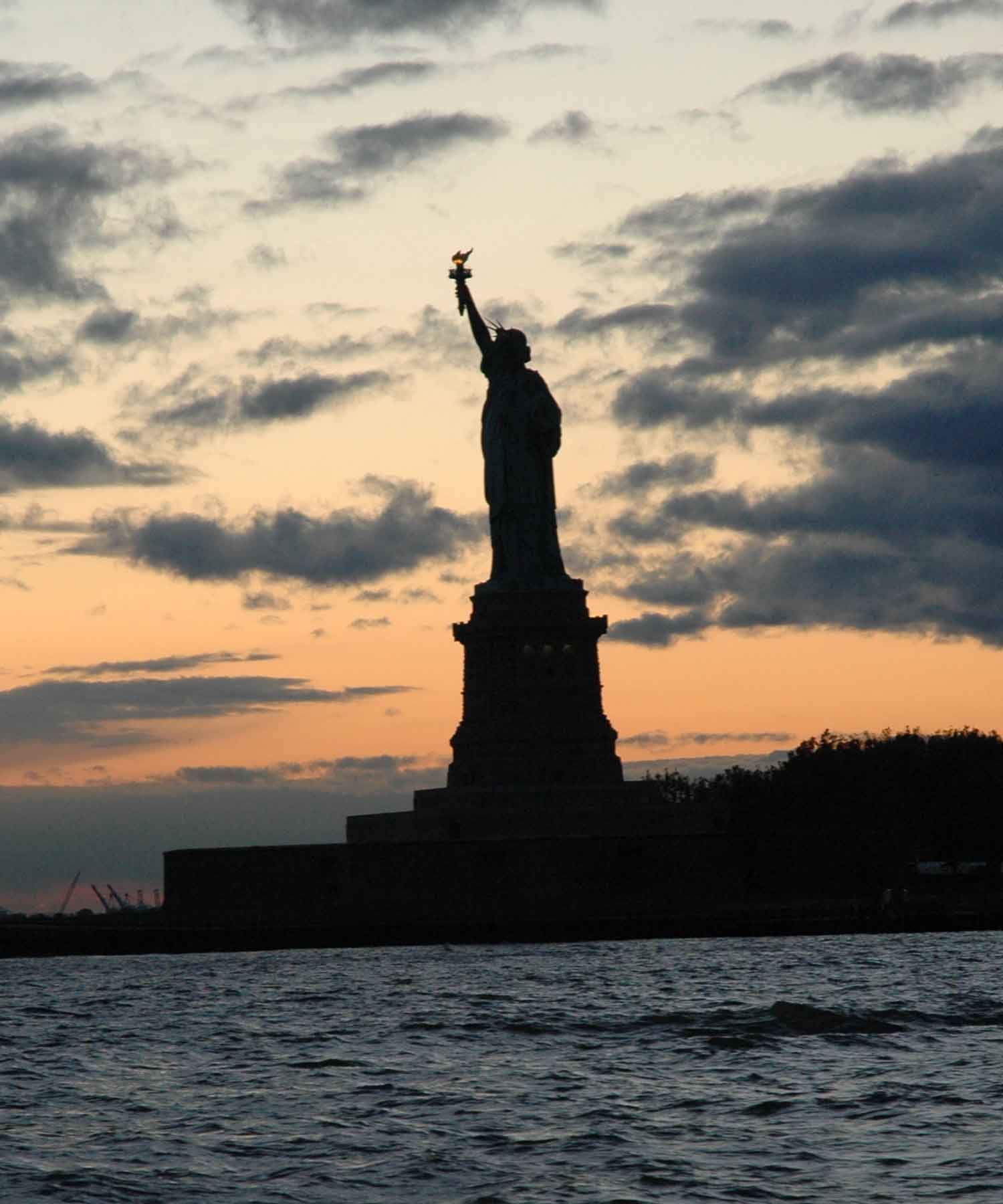
Day 2 – October 31st Halloween Cape Fear & Cape Hattaras!
Day 2 – October 31st Our Halloween Approach of Cape Fear & Cape Hattaras!

Ed enjoying some ocean sailing.
The winds died down to a beautiful calm and a sunny day. We kind of forgot what day it was, so I turned on the Satellite Radio just to relax a little and listen to some music. The radio announcer mentioned that it was Halloween, and they played a lot of holiday themed music most of the day.
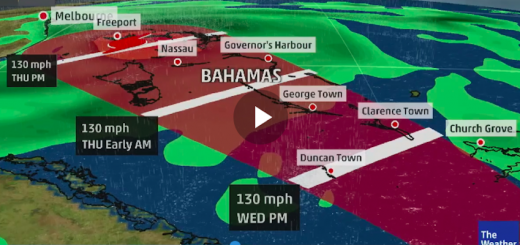
We all thought how appropriate, we will be rounding the most feared cape in North America at about Midnight on this Halloween night. Later that evening we would also pass Cape Fear. So why all the fear surrounding this cape? If you check our live GPS tracking and zoom in on satellite picture mode you will see the east coast landscape jetting out a couple hundred miles into the Atlantic. If you zoom in you’ll see what looks like a man made break wall, it is actually shallow waters, shoals, rocks and islands. Then you have the Gulf stream flowing up the east coast of the US from the Gulf, it rounds the bottom of Florida, and tracks up the coast about 100+ miles offshore. This current flows at about 1-2 knots, but near the top as it collides with the cape, and gets pushed out to sea, the speed increases to about 4 knots. Imagine a strong current like this in the ocean, it actually slowed our boat down to about 2 knots. Now if you have a strong north wind blowing south at the same time against the current, it produces very rough seas, and very large swells and breaking waves. Depending on the wind speed, and in storm conditions, it is very torturous and dangerous. There are many ship wrecks large and small in this area. Many slow moving vessels such as sail boats, will not even attempt rounding this cape in the best of weather. We were fortunate to round this cape in the calmest seas, however it still took almost 24 hours. If a heavy north winds crept in, or a storm caught us by surprise, we could have easily been caught in it. Due to this fear, most pleasure boats will go inland just north of the cape in to Norfolk, Virginia and use the inland inter-coastal waterways (ICW), and come out the bottom of the cape at Beaufort. This detour through the inter-coastal waterway would have added 3 days to our trip.

Paul catching up on some sleep.
Our boat is equipped with Sirius Satellite Live Global Weather, I would recommend having this, it was the most important tool on this journey. We also made good use of it in Lake Ontario. It tells us everything you could possibly want to know, Low/Hi pressure, wind speed and direction, water temperatures, current flow, precipitation, storm tracking direction and speed, hurricane tracker, tropical weather feeds, weather watches & warnings, plus a whole lot more. This data is not just for our area, but global, so we can see ahead before we get right into the thick of it. We never used the VHF radio weather reports, they were out of date anyways compared to our feed, plus 75 miles offshore and your VHF is out of range anyways. The water temperatures allowed us to see exactly where the gulf stream was since these are warmer waters.
We used this information to decide that it would be safe to round the cape, and make it to Florida before a tropical depression arrived. Had we went inside the cape, we would have lost 3 days, and had to wait another 3 days for the storm to pass. This same day we were hailed on the VHF radio by another sailboat about 3 miles ahead of us. We had a nice 20 minute conversation with this other boat, a 37 foot Island Packet named Navy Blue, crewed by a 70 year old man and his wife. They were headed down to the Bahamas, Central America and the Panama Canal. They asked us about rounding the cape, we gave them the weather report and told them we were going for it. Their response was, “You guys are young brave souls, and maybe with your faster boat you’ll make it around in time, but we are going on the inside.” Within about 12 hours they were out of radio range.

Peter could not be happier, just him and Stella ; )
The winds were so calm, that we had to run the motor for about 5 hours, making 6 knots. This gave us an opportunity to charge our batteries. I installed an upgraded 110 amp alternator on the boat, almost 3 times the power output of the standard units. It virtually turns our motor into a 40HP diesel generator. I did not want to install an actual generator, mostly due to the extra weight (200lbs, after all its still a racer/cruiser), wasted precious storage space, and of course the price tag of about $8,000. However, that would have allowed us to run the air conditioner and heater offshore, and charge batteries without running the motor. We have 1 engine battery, 5 house batteries for operating everything else on the boat, and 1 Canadian Tire special reserve battery for boosting in case of emergencies. We also have a 2000 watt inverter, which gives us 110 amp house type outlets on the boat, allowing us to run what ever we want, including the microwave and kettle. Just don’t try to use the heater, microwave and kettle at the same time. We did that on shore, along with the TV, DVD, lights and a whole bunch of other gadgets. We fried the marinas electrical extension cord to a crisp. No damage to the boat’s electrical system.

Ed posing with the full black Spinnaker.
The winds did not pick up for the entire day, so after the batteries were charged, we decided to turn off the motor and fly the spinnaker chute. We have an asymmetric spinnaker, with a bow sprit at the bow that sticks out about 2 feet, allowing the sail to clear the anchor and bow pulpit. The clews are connect to the aft pulley eyelets of the boat, and the sail can be controlled from the cock pit. We found that once raised the spinnaker can be sailed single handed in lighter air. We could not believe how light the wind was 2-3 knots, but with the 1,200 square foot spinnaker and almost 500 square foot main, total sail area of about 1,700 sqft, we were still able to keep the boat moving at about 3-4 knots, in gusts we could hit 5 knots.

Under Spinnaker in Lake Ontario during the LO300 race.
We decided to pull the spinnaker down just before dark, just in case the wind suddenly picked up, we did not want to risk rounding the cape under spinnaker in the dark. So after a very nice BBQ steak dinner in the cock pit over flat calm seas, we turned on the motor and ended up running it for about 24 hours until the next morning when the wind finally picked up, but we were well past the cape by now, and about half of the way down the Chesapeake Bay area.

Paul & Peter enjoy a BBQ Steak!

Cez & Ed, so excited about the BBQ Steak they could kiss each other.

Sun Set that same evening right after our BBQ.